Long-Term Forest Monitoring
Our long-term measurement study is part of a larger study comparing unmanaged and managed forests across New England. This project stems from the Wildlands and Woodlands vision for forest protection. Our work will involve one hundred 20 x 20 meter plots in Weston's town forest that will be re-measured on a 2-5 year interval. Data collected include the following:
- Diameter at Breast Height (DBH) and species of all stems in the plot
- Understory vegetation species and percent cover
- Standing deadwood species and DBH
- Coarse Woody Debris volume, species, and decay class
- Environmental variables such as slope, aspect, and soil characteristics
In order to establish our long-term plots, we first completed an inventory of the Weston town forest. The data and species percentage maps are available below. Click on an image to open a larger version of that image. Right click on the larger image and select Save Image As to download the image.
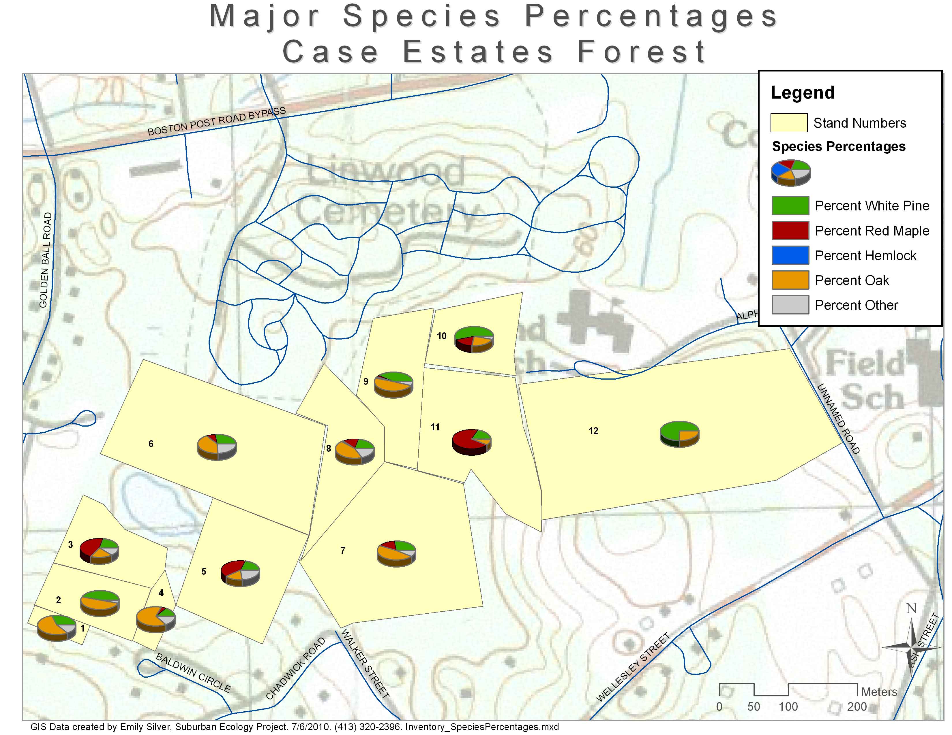
Case Estates Forest
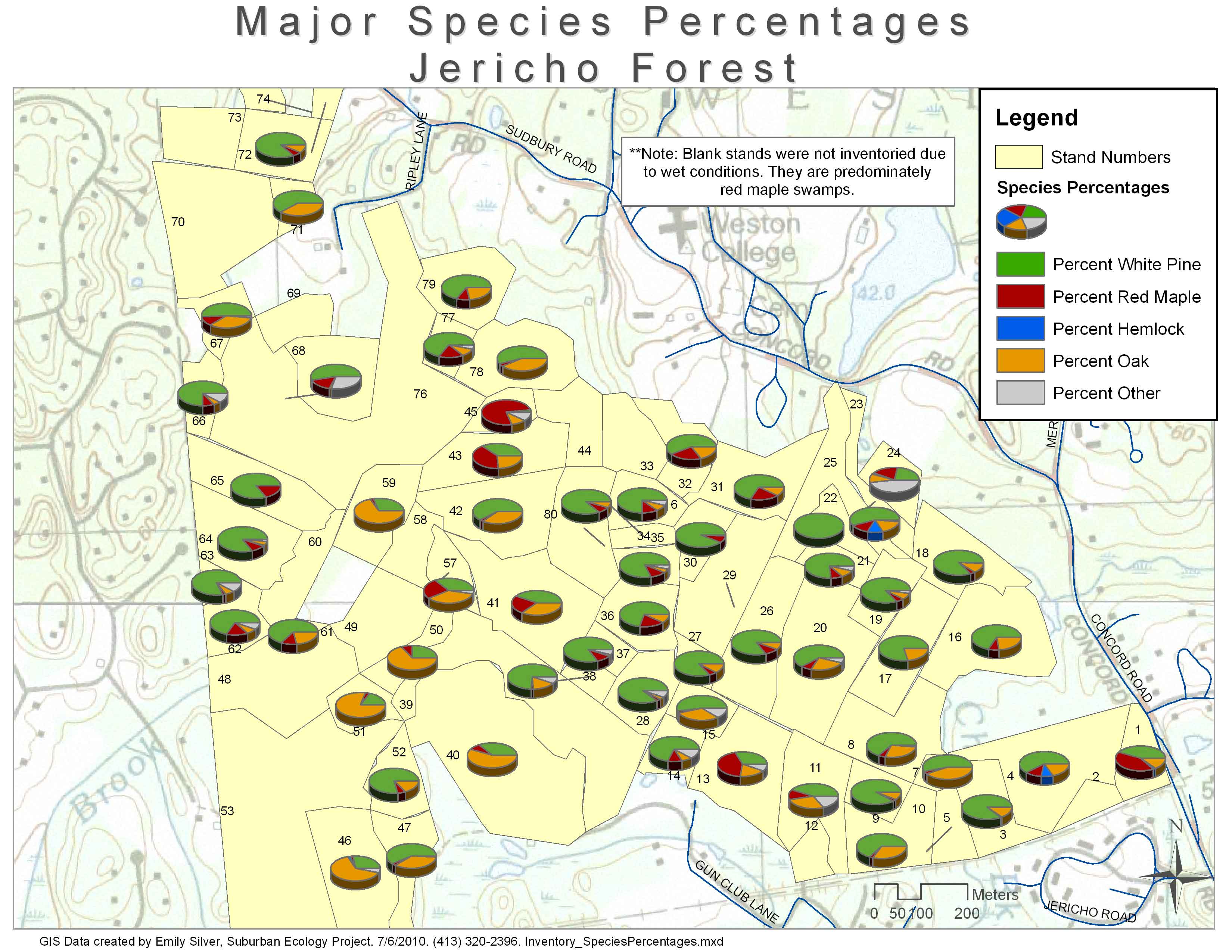
Jericho Forest
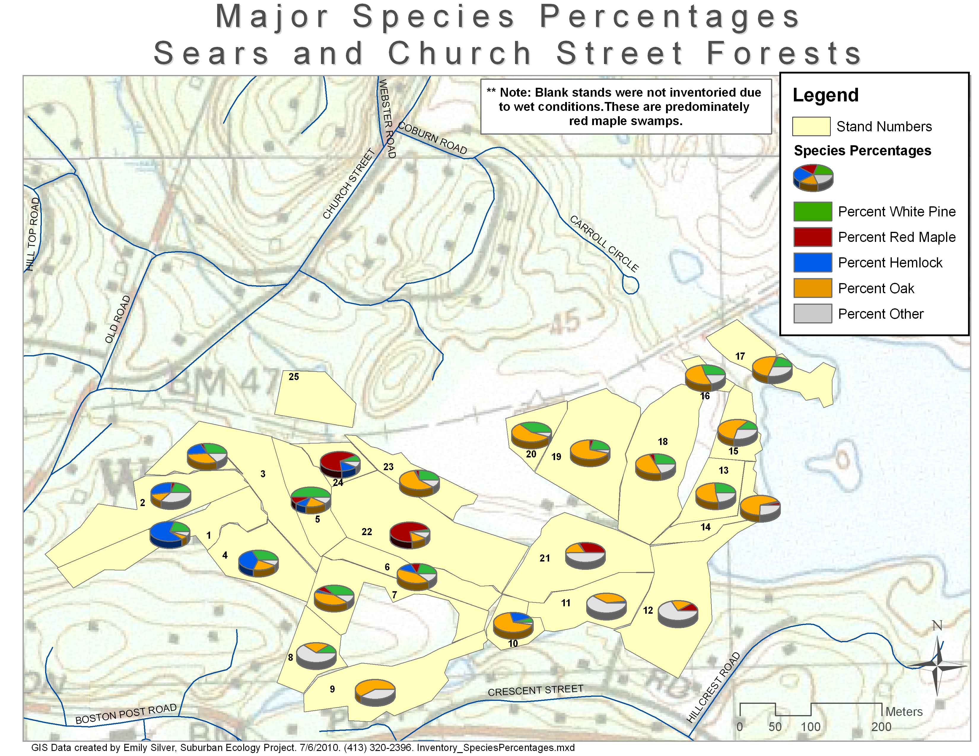
Sears and Church Street Forests
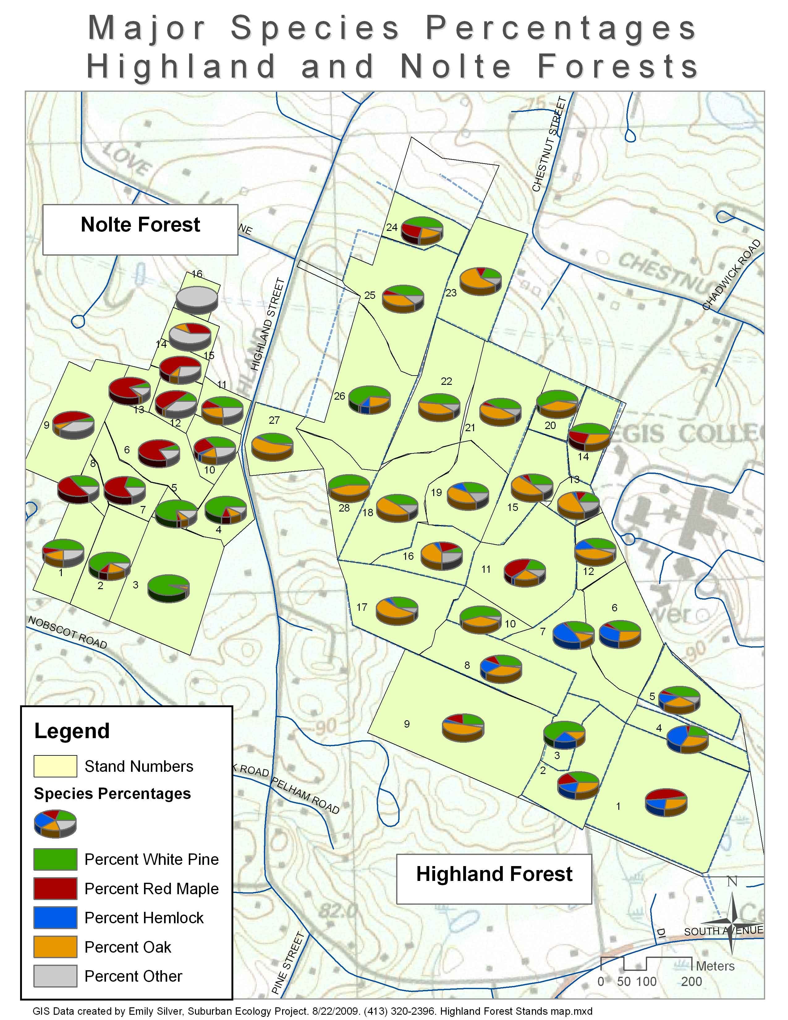
Highland and Nolte Forests
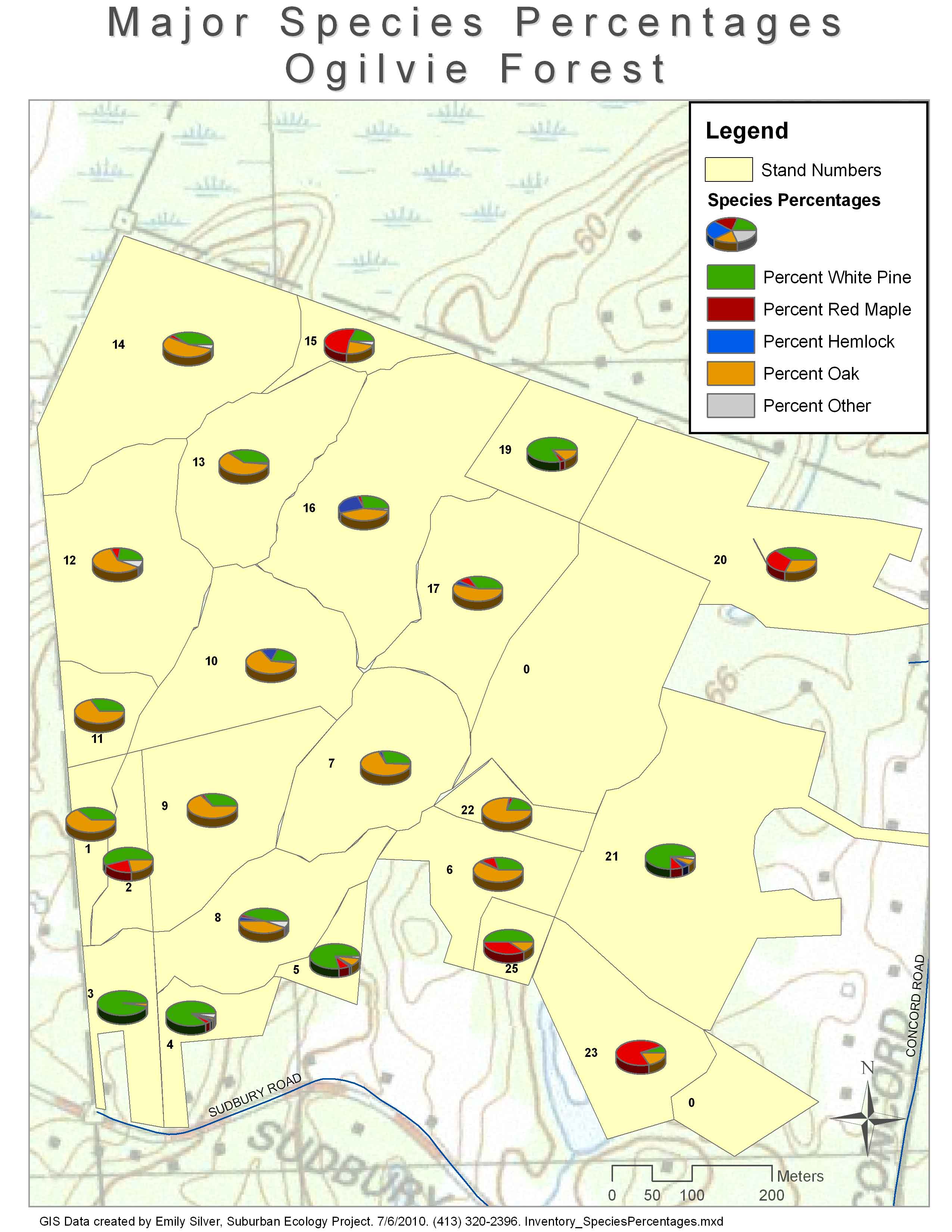
Ogilvie Forest
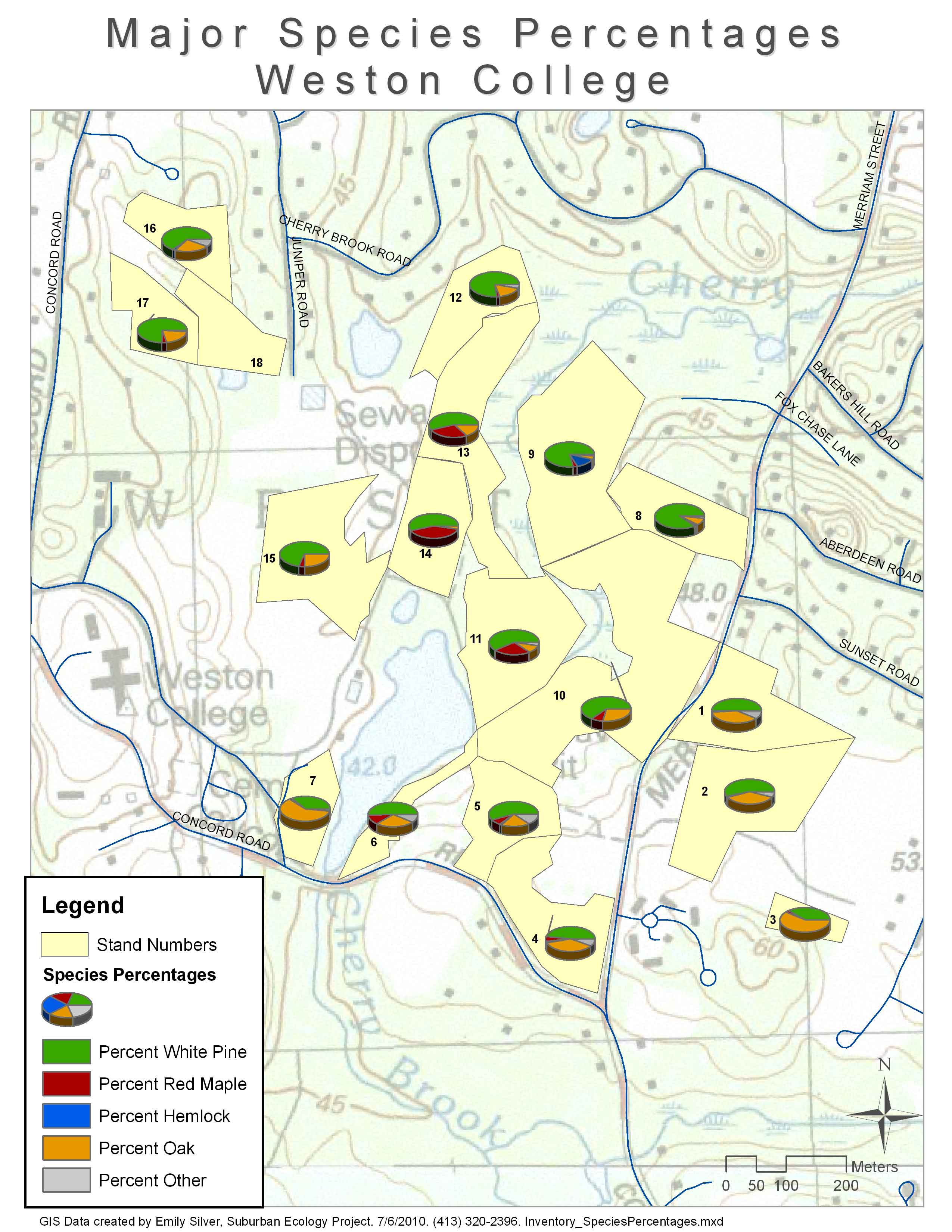
Weston College