The Maps We Use
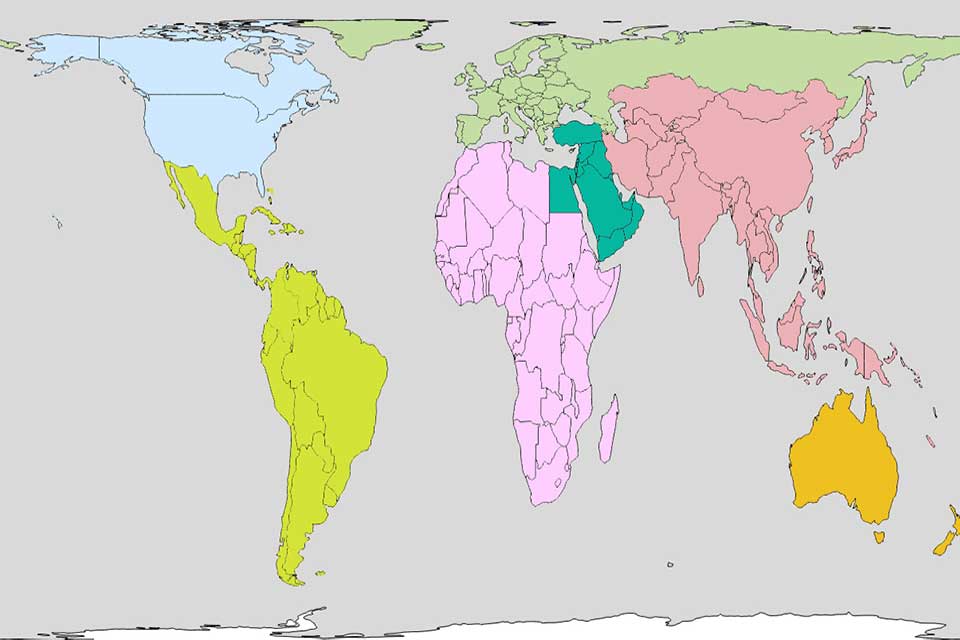
As you explore the Study Abroad website, you may see the map above and wonder why it looks slightly different than maps you are used to seeing. This map is an example of the Gall-Peters Projection, which takes care to demonstrate accurate relative size and location of nations around the world. This map was adopted for use in the Boston Public Schools in 2017, and our office believes it is the most inclusive and equitable map to display the vast opportunities that exist throughout the world.
Maps are important. From a young age, they create entrenched understandings of what is big and what is small, where we should look and what we think we see. The cartographer's challenge is to portray the spherical earth on a flat surface, a task that will by definition distort some aspect of the map.
The map that many people remember from elementary school, the Mercator Projection, was originally designed by the Flemish cartographer Gerardus Mercator in 1569. It was designed at a time when ships traveled regularly from Europe to the Western Hemisphere and seafarers needed a reliable way to track their progress across the ocean. The Mercator Projection did an excellent job of this by creating straight lines across the ocean for ships to navigate. In doing so, however, the map distorted the size of countries that are farther from the equator, inaccurately portrays the total land mass that countries occupy in relation to one another, and disproportionately highlights Europe and North America.
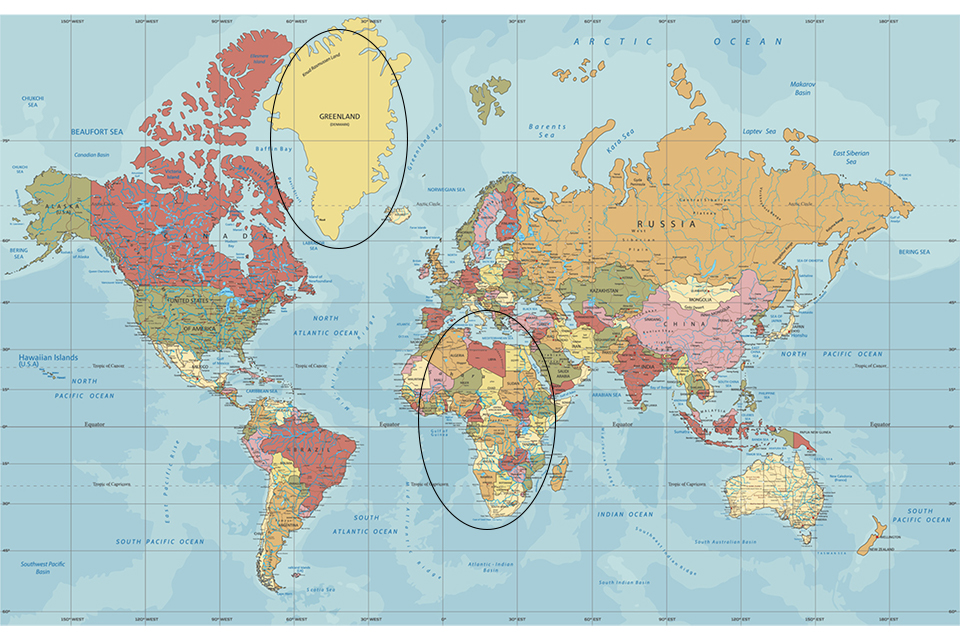
For example, take Greenland. Given its distance from the equator, the Mercator Projection distorts Greenland by making it look approximately the same size as continental Africa. However, Africa covers 11.73 million square miles, whereas Greenland covers only a little more than 836,000 square miles.
The Mercator Projection is not wrong. In helping ships navigate in a straight line across a round globe, it does what it was designed to do. But as students approach the task of looking outside the U.S. for new places to study and grow, a map that inaccurately portrays the relative size and location of Europe and North America is not the right lens through which to look at the world.
The Gall-Peters Projection provides an equitable way for Brandeis students, staff, faculty and community members to view our diverse world. It has its drawbacks as well. For example, some find it less visually appealing, and it does distort the shape of some countries that are stretched to preserve relative size. But we feel this map provides the most equal perspective on our wide world. As students prepare for the eye-opening experience of stepping into another culture and studying abroad, we encourage them to embrace new perspectives and strive to understand the world through the eyes of those in their host communities and societies.
Please contact any member of the Study Abroad staff with questions or to discuss this further.